Alcenago - Grezzana
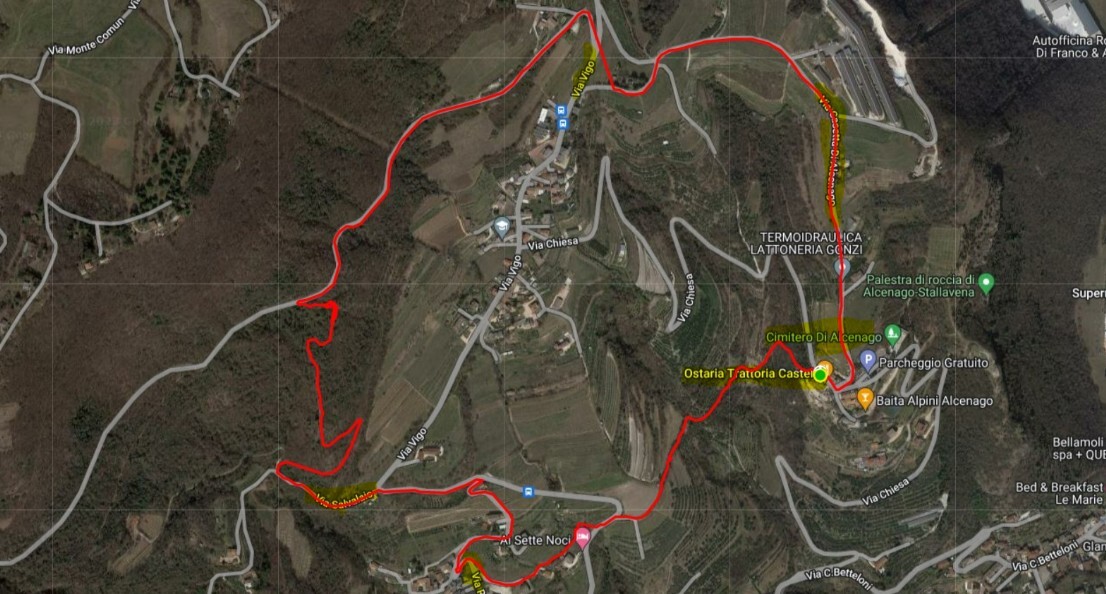
Alcenago - Osteria Castel - Rupiano - Via Vigo - Via Casetta di Alcenago - Chiesa di Alcenago

Starting point : Alcenago - Ostaria Castel
GPS : 45.5471943, 10.9937185
Difference in height uphill 200 mt
Lenght km 5
duration 1 hour 30'
Brief description
Circular route with departure from Alcenago, exactly from Osteria Al Castel starts in steep downhill path and then continues halfway up the hill. We go up to Rupiano. We stop at the small church and the historic Lavatoio. From here we walk a short uphill stretch and then take the path that passes through the vegetation.
It takes us up to take the road that descends from Monte Comun to Vigo. We enter Via Casetta di Alcenago (wonderful views) and always descend on asphalt next to the church of Alcenago and the Ostaria Castel from where we started. 5 kilometers and 200 meters difference in altitude

