Rifugio Bertagnoli - Malga Campodavanti concerto 2013
A beautiful excursion made in the year 2013.
At the Anderloni concert at Malga Campodavanti.
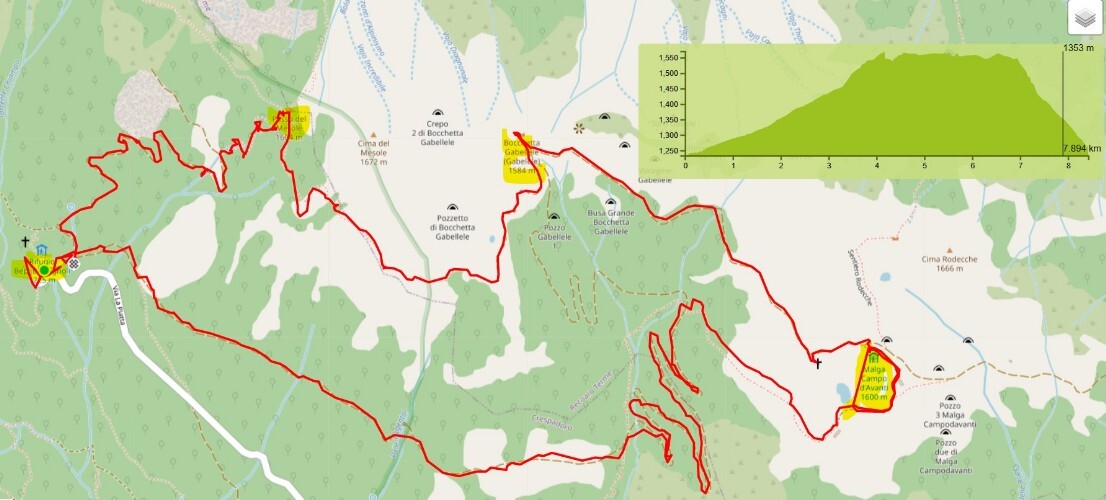
Departure from the Bertagnoli Refuge in the upper Val di Chiampo.
follow signs for Malga Campodavanti. The path and on a dirt road leads us to the hut. Here we attend and enjoy the concert.
After the concert we walk along the path 202 of the Italian Alpine Club up to Bocchetta Gabellele and continuing on the same up to Passo Mesole and from here we descend to the starting point, the Bertagnoli refuge.
We covered 9 kilometers and made a difference in altitude of 500 meters uphill

Starting point : Rifugio Bertagnoli
GPS : 45.6734253, 11.16521762
Uphill difference in height 500 mt
Lenght km 9
duration 4 hours
hiking---excellent senaletica
Brief description
Rifugio Bertagnoli - Malga Campodavanti - Bocchetta Gabellele - Passo Mesole - path CAI 202 - Bertagnoli

